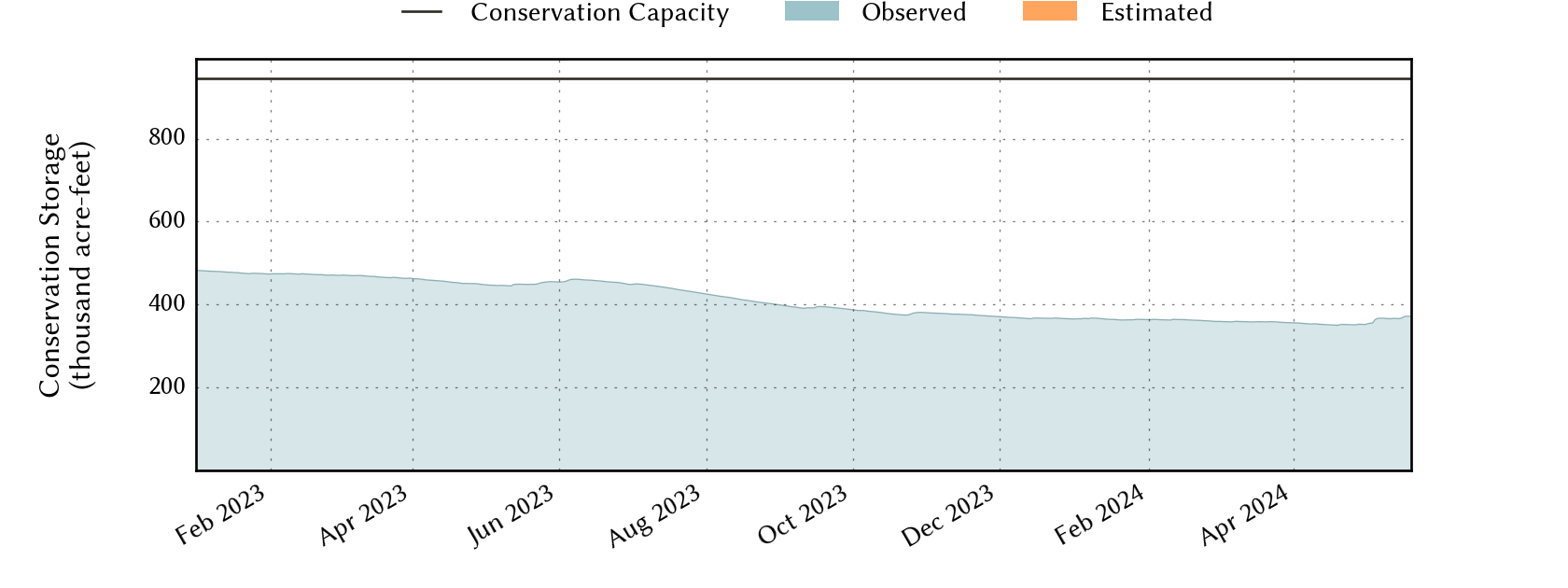
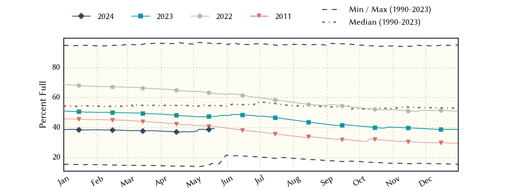
Abilene Area Reservoirs: Monitored Water Supply Reservoirs are 37.3% full on 2024-04-28
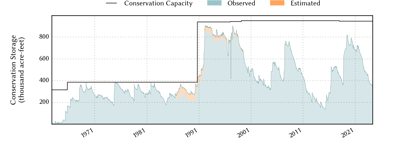
Historical Data
| Date | Percent Full |
Reservoir Storage (acre-ft) |
Conservation Storage (acre-ft) |
Conservation Capacity (acre-ft) |
|
|---|---|---|---|---|---|
| Today | 2024-04-28 | 37.3 | 357,267 | 352,385 | 945,568 |
| Yesterday | 2024-04-27 | 37.1 | 355,852 | 350,970 | 945,568 |
| 2 days ago | 2024-04-26 | 37.2 | 356,199 | 351,317 | 945,568 |
| 1 week ago | 2024-04-21 | 37.2 | 357,089 | 352,207 | 945,568 |
| 1 month ago | 2024-03-28 | 37.7 | 361,725 | 356,843 | 945,568 |
| 3 months ago | 2024-01-28 | 38.5 | 369,015 | 364,133 | 945,568 |
| 6 months ago | 2023-10-28 | 40.3 | 385,863 | 380,981 | 945,568 |
| 1 year ago | 2023-04-28 | 47.6 | 454,864 | 449,982 | 945,568 |
*
Percent Full is based on Conservation Storage and Conservation Capacity and doesn't account for storage in flood pool.
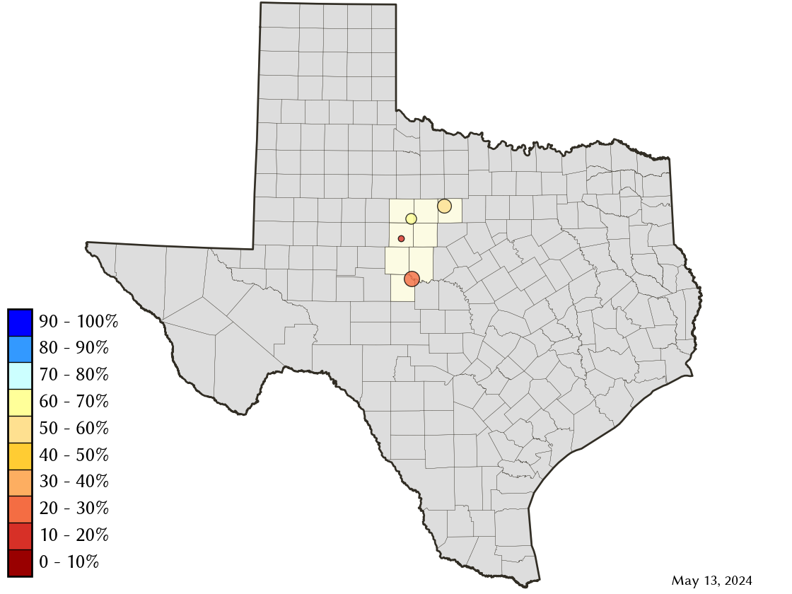
Area Map
Reservoir Storage
| Reservoir | Percent Full |
Water Level (ft) |
Height Above Conservation Pool (ft) |
Reservoir Storage (acre-ft) |
Conservation Storage (acre-ft) |
Conservation Capacity (acre-ft) |
Surface Area (acres) |
|---|---|---|---|---|---|---|---|
| Abilene | 11.6 | 1,993.64 | -18.66 | 920 | 920 | 7,900 | 167 |
| Fort Phantom Hill | 67.0 | 1,629.14 | -6.76 | 46,959 | 46,953 | 70,030 | 2,983 |
| Hubbard Creek | 50.7 | 1,171.21 | -12.10 | 163,695 | 158,819 | 313,298 | 10,050 |
| O H Ivie | 26.3 | 1,519.77 | -31.73 | 145,693 | 145,693 | 554,340 | - n.a. - |