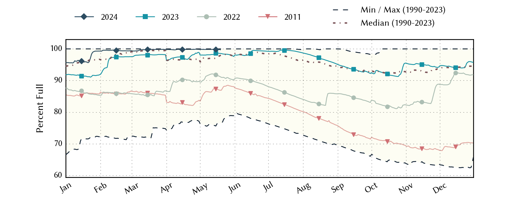
North-East-Texas Planning Region Reservoirs: Monitored Water Supply Reservoirs are 99.9% full on 2024-04-28
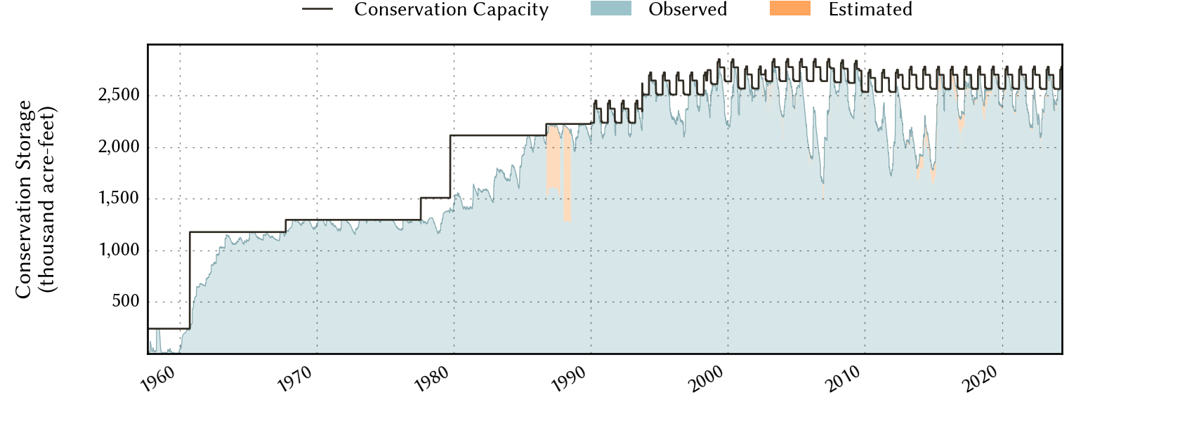
Historical Data
| Date | Percent Full |
Reservoir Storage (acre-ft) |
Conservation Storage (acre-ft) |
Conservation Capacity (acre-ft) |
|
|---|---|---|---|---|---|
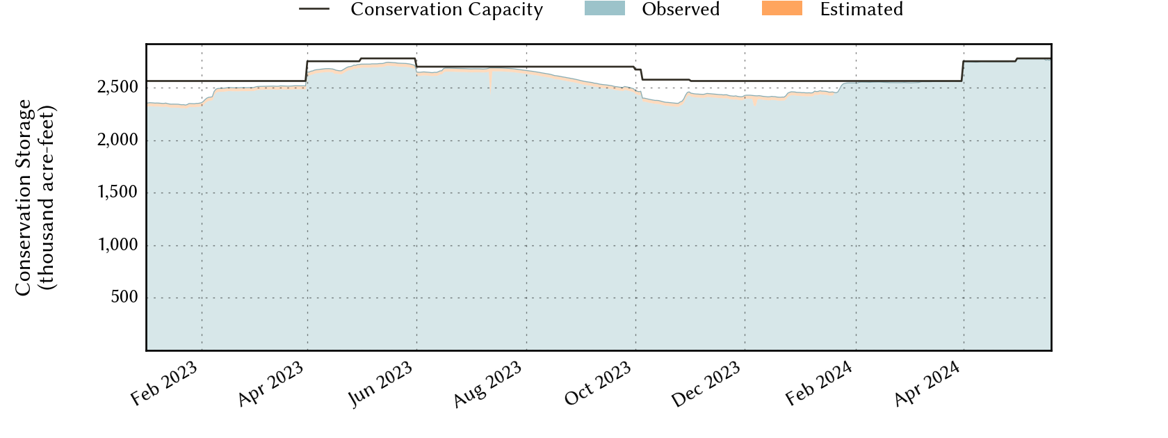
| Today | 2024-04-28 | 99.9 | 3,290,300 | 2,749,033 | 2,751,650 |
| Yesterday | 2024-04-27 | 99.9 | 3,294,069 | 2,749,504 | 2,751,650 |
| 2 days ago | 2024-04-26 | 99.8 | 3,272,481 | 2,747,196 | 2,751,650 |
| 1 week ago | 2024-04-21 | 99.9 | 3,353,784 | 2,747,728 | 2,751,650 |
| 1 month ago | 2024-03-28 | 99.8 | 3,239,547 | 2,559,385 | 2,563,861 |
| 3 months ago | 2024-01-28 | 99.3 | 3,119,987 | 2,545,890 | 2,563,861 |
| 6 months ago | 2023-10-28 | 92.9 | 2,686,537 | 2,392,375 | 2,576,337 |
| 1 year ago | 2023-04-28 | 98.6 | 2,939,982 | 2,712,943 | 2,751,650 |
*
Percent Full is based on Conservation Storage and Conservation Capacity and doesn't account for storage in flood pool.
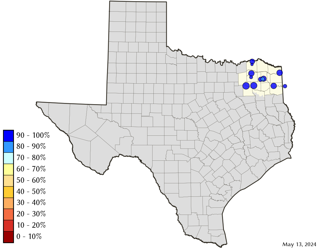
Area Map
Reservoir Storage
| Reservoir | Percent Full |
Water Level (ft) |
Height Above Conservation Pool (ft) |
Reservoir Storage (acre-ft) |
Conservation Storage (acre-ft) |
Conservation Capacity (acre-ft) |
Surface Area (acres) |
|---|---|---|---|---|---|---|---|
| Bob Sandlin | 100.0 | 338.15 | 0.65 | 208,967 | 192,417 | 192,417 | - n.a. - |
| Caddo 1 | 100.0 | 170.26 | 1.76 | 177,440 | 29,898 | 29,898 | 30,610 |
| Crook | 99.8 | 475.98 | -0.02 | 9,189 | 9,174 | 9,195 | 1,057 |
| Cypress Springs | 100.0 | 380.73 | 2.73 | 75,858 | 66,756 | 66,756 | - n.a. - |
| Fork | 100.0 | 403.64 | 0.64 | 653,679 | 605,061 | 605,061 | - n.a. - |
| Jim Chapman | 100.0 | 441.05 | 1.05 | 313,716 | 258,723 | 258,723 | 18,613 |
| Lake O' the Pines | 100.0 | 233.82 | 5.32 | 344,652 | 241,363 | 241,363 | - n.a. - |
| Monticello | 92.6 | 338.71 | -1.29 | 32,181 | 32,181 | 34,740 | 1,884 |
| Pat Mayse | 100.0 | 453.11 | 2.11 | 129,980 | 113,683 | 113,683 | - n.a. - |
| Sulphur Springs | 99.8 | 458.93 | -0.02 | 17,710 | 17,710 | 17,747 | - n.a. - |
| Tawakoni | 100.0 | 438.74 | 1.24 | 918,374 | 871,685 | 871,685 | - n.a. - |
| Wright Patman | 100.0 | 230.18 | 2.68 | 408,554 | 310,382 | 310,382 | - n.a. - |
footnotes
1
Caddo Lake straddles the border of Texas and Louisiana, Texas has rights to 50% of Lake Caddo's total conservation capacity. Percent full, conservation storage and conservation capacity are based on the Texas share.