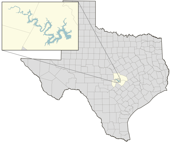
Lake Travis: 39.3% full as of 2024-05-18
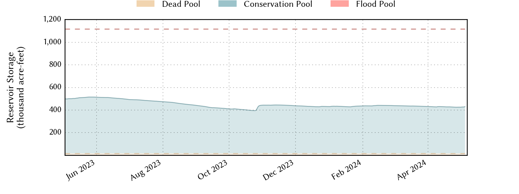
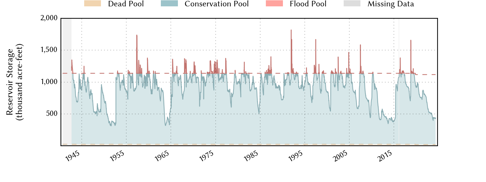
The elevation-storage rating curve used to produce the storage hydrograph is made of two segments: (1) the segment up to the conservation pool top (below the red line) is based on measured data, and (2) the segment in the flood pool (above the red line) is an extrapolation from the first segment and shouldn't be relied upon for flood storage information.
Historical Data
| Date | Percent Full |
Mean Water Level (ft) |
Reservoir Storage (acre-ft) |
Conservation Storage (acre-ft) |
Conservation Capacity (acre-ft) |
Surface Area (acres) |
|
|---|---|---|---|---|---|---|---|
| Today | 2024-05-18 | 39.3 | 632.85 | 448,218 | 431,186 | 1,098,044 | 9,572 |
| Yesterday | 2024-05-17 | 39.2 | 632.74 | 447,166 | 430,134 | 1,098,044 | 9,557 |
| 2 days ago | 2024-05-16 | 38.9 | 632.47 | 444,590 | 427,558 | 1,098,044 | 9,520 |
| 1 week ago | 2024-05-11 | 38.8 | 632.29 | 442,879 | 425,847 | 1,098,044 | 9,495 |
| 1 month ago | 2024-04-18 | 37.3 | 630.58 | 426,846 | 409,814 | 1,098,044 | 9,258 |
| 3 months ago | 2024-02-18 | 38.5 | 632.00 | 440,131 | 423,099 | 1,098,044 | 9,455 |
| 6 months ago | 2023-11-18 | 38.8 | 632.31 | 443,069 | 426,037 | 1,098,044 | 9,498 |
| 1 year ago | 2023-05-18 | 44.8 | 638.88 | 508,594 | 491,562 | 1,098,044 | 10,458 |
*
Percent Full is based on Conservation Storage and Conservation Capacity and doesn't account for storage in flood pool.
**
Values above, including today's are averaged conditions. For near real-time instantaneous water level, see table below or the interactive map viewer.
Most Recent Instantaneous Water Level
| Date/time |
Water Level (ft) |
Conservation Pool Elevation (ft) |
Height Above Conservation Pool (ft) |
|
|---|---|---|---|---|
| Most recent | 2024-05-18 21:00 | 632.86 | 681.00 | -48.14 |
| 1 hour prior | 2024-05-18 20:00 | 632.87 | 681.00 | -48.13 |
| 2 hours prior | 2024-05-18 19:00 | 632.88 | 681.00 | -48.12 |
| 6 hours prior | 2024-05-18 15:00 | 632.87 | 681.00 | -48.13 |
| 12 hours prior | 2024-05-18 09:00 | 632.87 | 681.00 | -48.13 |
| 24 hours prior | 2024-05-17 21:00 | - n.a. - | - n.a. - | - n.a. - |
| 48 hours prior | 2024-05-16 21:00 | - n.a. - | - n.a. - | - n.a. - |
*
Data is provisional and subject to revision.
Additional Information
| Impoundment date | 1942-01-01 |
| Vertical datum | NAVD88 +0.6 |
| Dead pool elevation | 535.75 ft above NAVD88 +0.6 |
| Emergency spillway crest elevation | 714.00 ft above NAVD88 +0.6 |
| Flood pool elevation | 721.40 ft above NAVD88 +0.6 |
| Maximum design elevation | 745.00 ft above NAVD88 +0.6 |
| Top of dam elevation | 750.00 ft above NAVD88 +0.6 |
| Conservation pool elevation | 681.00 ft above NAVD88 +0.6 |
| Data download (CSV) | period of record, last one year, last 30 days |
Elevation-Area-Capacity Curves
2008-07-01 (source: TWDB)
: GIS Data
2019-11-01 (source: TWDB)
: GIS Data
|
|
| Data Source | LCRA:3963 |
Lake Location