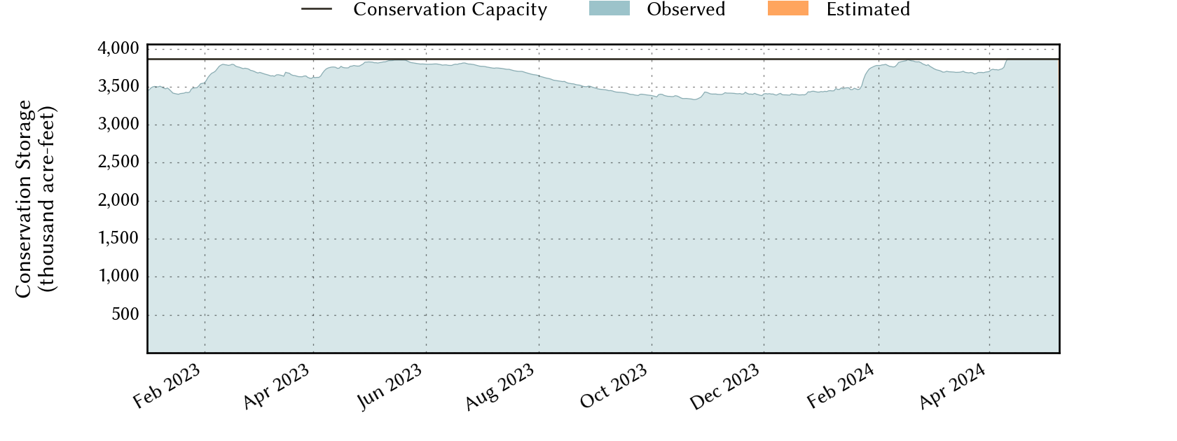
Sabine River Basin Reservoirs: Monitored Water Supply Reservoirs are 93.0% full on 2026-07-31
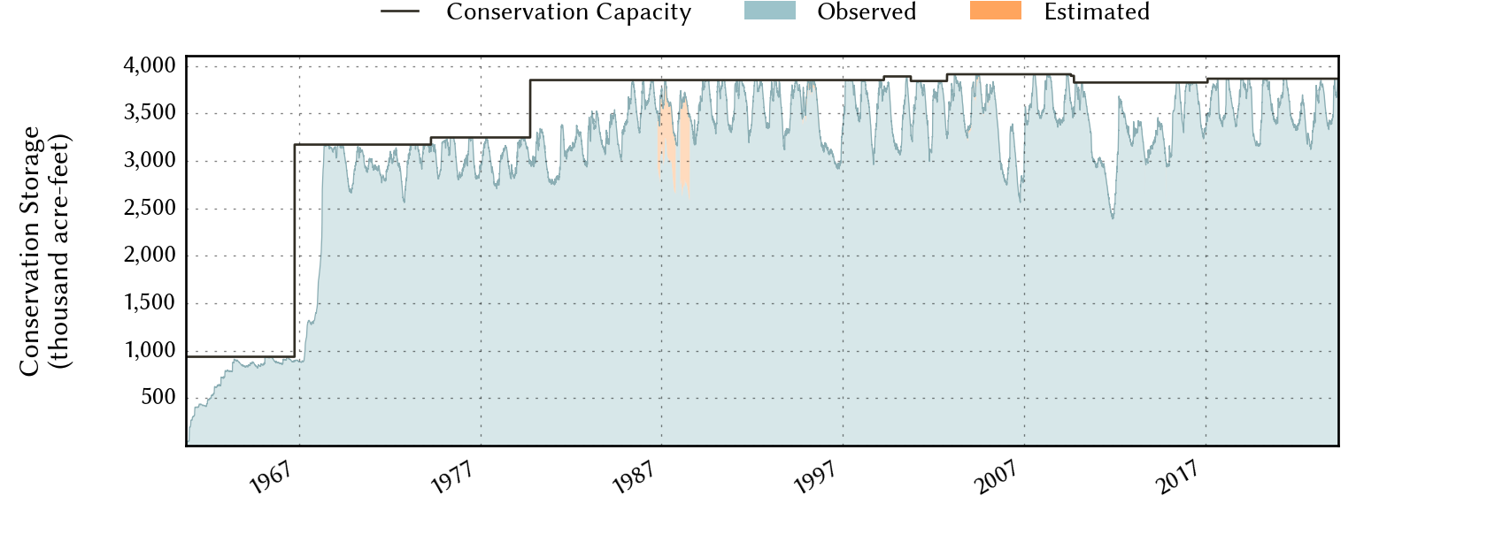
Historical Data
| Date | Percent Full |
Reservoir Storage (acre-ft) |
Conservation Storage (acre-ft) |
Conservation Capacity (acre-ft) |
|
|---|---|---|---|---|---|
| Today | 2026-07-31 | 93.0 | 5,698,697 | 3,597,563 | 3,868,328 |
| Yesterday | 2026-07-30 | 93.1 | 5,707,183 | 3,602,678 | 3,868,328 |
| 2 days ago | 2026-07-29 | 93.3 | 5,719,321 | 3,609,817 | 3,868,328 |
| 1 week ago | 2026-07-24 | 93.9 | 5,754,358 | 3,632,505 | 3,868,328 |
| 1 month ago | 2026-06-30 | 95.8 | 5,882,822 | 3,707,110 | 3,868,328 |
| 3 months ago | 2026-04-30 | 92.0 | 5,606,478 | 3,560,222 | 3,868,328 |
| 6 months ago | 2026-01-31 | 86.9 | 5,292,206 | 3,363,207 | 3,868,328 |
| 1 year ago | 2025-07-31 | 96.2 | 5,860,271 | 3,720,991 | 3,868,328 |
*
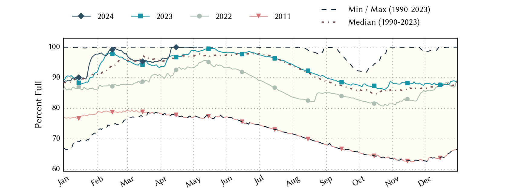
Percent Full is based on Conservation Storage and Conservation Capacity and doesn't account for storage in flood pool.
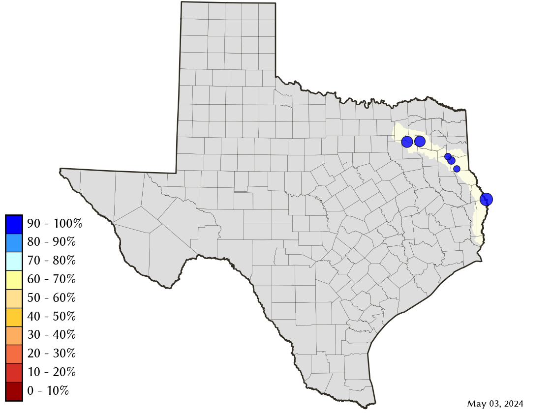
Area Map
Reservoir Storage
| Reservoir | Type | Percent Full |
Water Level (ft) |
Height Above Conservation Pool (ft) |
Reservoir Storage (acre-ft) |
Conservation Storage (acre-ft) |
Conservation Capacity (acre-ft) |
Surface Area (acres) |
|---|---|---|---|---|---|---|---|---|
| Cherokee |

|
96.9 | 279.56 | -0.44 | 43,246 | 38,864 | 40,094 | 3,593 |
| Fork |
|
87.9 | 400.14 | -2.86 | 564,344 | 532,901 | 606,088 | 24,291 |
| Martin |
|
92.3 | 304.79 | -1.21 | 69,865 | 69,865 | 75,726 | 4,734 |
| Murvaul |
|
96.7 | 264.93 | -0.37 | 37,023 | 37,023 | 38,285 | 3,389 |
| Tawakoni |
|
98.4 | 437.12 | -0.38 | 857,717 | 857,709 | 871,685 | 36,554 |
| Toledo Bend 1 |
|
92.2 | 169.85 | -2.15 | 4,126,502 | 2,061,201 | 2,236,450 | 172,115 |
footnotes
1
Toledo Bend Reservoir straddles the border of Texas and Louisiana, Texas has rights to 50% of Toledo Bend Reservoir's total conservation capacity. Percent full, conservation storage and conservation capacity are based on the Texas share.